ANR JCJC SITEMSA: Sea Ice Thickness Estimation and Modeling from SAR and Altimetry
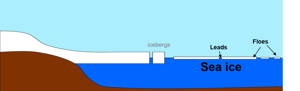
Arctic sea ice extent has been decreasing dramatically in recent years. This decrease in the sea ice extent comes with a diminution of the sea ice thickness (SIT), with the disappearance of the multi-year ice. New-year ice being mechanically weaker, the variability of sea ice conditions throughout the years increases, with more observations of SIT anomalies, early break up or acceleration of the sea ice drift (SID).
In this context, the goal of the ANR JCJC SITEMSA project is to:
- Map floes and leads in sea ice by deep learning using SAR and optical images to assess the change in arctic sea-ice structure.
- Create a synergy between images and radar altimetry to both:
- Robustify the SIT measurement by attributing image characteristic to waveforms and grouping them by measured objects
- Propagate the SIT measured by radar altimetry to sea ice near the altimetric tracks using SAR and optical images.
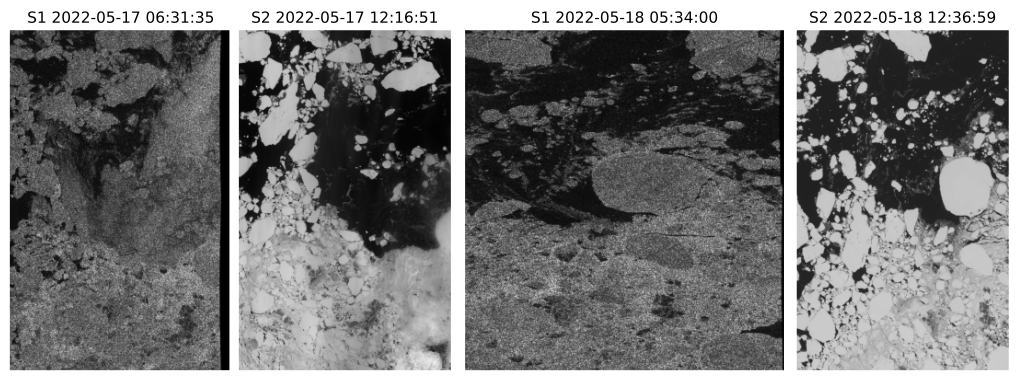
- Measure high-resolution local sea-ice drift to evaluate the evolution of the drift in coastal areas. The SID measurement also helps to corregistrate optical, SAR and altimetric measurements acquired within a few hours and up to a few days. Since the existing correlation methods do not provide results at the targeted scale of 100m, we propose to introduce a deep learning base strategy. We overcome the lack of existing labeled data by simulating optics and SAR pairs in various displacement situations. This dataset is then used to fine-tune existing deep learning architectures or train new ones.
The study area is mostly focused on Svalbard.
Team
- Laura Orgambide (PhD candidate on CNES and ONERA funding from 10/2023)
- Houda Hassini (Post-doctoral researcher on ANR JCJC SITEMSA funding from 11/2024)
- Michelangelo Mussini (PhD candidate on ANR JCJC SITEMSA funding from 11/2025)
Mapping floes and leads in SAR images by deep-learning
Two complementary methodologies are foreseen:
a. weakly supervised learning buiding on concentration maps obtained from ASMR2, which are widely available
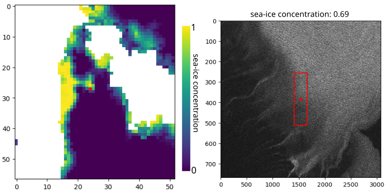
b. segmentic segmentation based on sea-ice floes detection done on optical images. Sea-ice optical images are only available between March and May every year, and their availability is decreased by clouds.
Synergy between SAR and altimetry
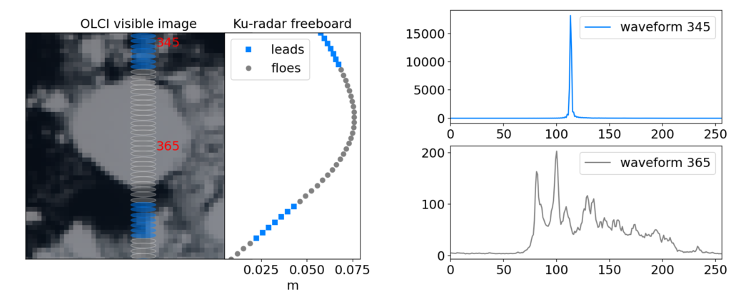
The Sentinel-3 satellites carry a medium-resolution optical sensor OLCI as well as an radar altimeter SRAL. From these data, the link between image and altimetry can be constructed without coregistration issues. This is illustrated on the following figue representing the SRAL track on the OLCI image and the Ku-radar freeboard computed from the classified SRAL waveforms. Two SRAL waveforms, one over a lead and one over a floe are shown.
Measuring sea-ice drift
Two approaches are currently under study.
a. Following the litterature, a SID algorithm base on key-points is being developped. Since the goal is to retrieve local SID, the idea is to group key-points per floe to measure each floe translation and rotation instead of a global displacement
b. Multiple deep-learning methods have been developped to measure displacement. On the absence of ground truth, we aim to rely either on the image simulation or on self-supervised methods.